Overview
From Kampala to Jinja by road is 80 kilometres along National Highway A109 — a journey of 1.5 to 3.5 hours depending on transport type and time of day. The route runs east from the capital to Jinja, Uganda's adventure capital on the source of the White Nile. This guide covers every practical option for travelling from Kampala to Jinja in 2026: shared minibus taxis (matatus) from Old Park stage, express coaches, private hire, and pre-booked transfers — with current costs, realistic journey times by time of day, and the key landmarks you will pass along the way.
From Kampala to Jinja: The Route at a Glance
The journey from Kampala to Jinja begins at Old Park taxi stage in central Kampala — the main departure point for shared minibus taxis heading east. From there, the A109 runs approximately 80 kilometres through the Nakawa and Mukono divisions before opening onto the Namanve industrial corridor and then the final approach into Jinja across the Owen Falls Dam bridge. Under normal traffic conditions, allow 1.5 to 2.5 hours. Departing between 07:00 and 09:30 on weekdays, allow 3 hours or more. The single most effective strategy for a faster journey from Kampala to Jinja is an early departure — before 07:00 on weekdays, or any time on a weekend morning.
Best Time to Travel from Kampala to Jinja
| Departure window | Expected journey time | Conditions |
|---|---|---|
| 05:30–07:00 | 1.5 hrs | Fastest. Minimal traffic through Kampala. |
| 07:00–09:30 (weekday) | 3+ hrs | Peak rush hour. Avoid if possible. |
| 09:30–15:00 | 2–2.5 hrs | Moderate. Reliable for daytime travel. |
| 15:00–19:00 (weekday) | 2.5–3.5 hrs | Return rush builds from Jinja direction too. |
| Weekend mornings | 1.5–2 hrs | Recommended for day trips. |
Understanding Kampala: The City Every Journey Passes Through
Kampala is not simply Uganda's capital — it is the metropolitan engine of the entire country. The wider metropolitan area, encompassing Kampala, Wakiso, and Mukono, concentrates over 32% of Uganda's manufacturing activity, according to economic analysis of the capital region. The city generates approximately 65% of Uganda's national GDP, making it one of the most economically dominant urban centres in sub-Saharan Africa relative to national output (Kampala Multi-Hazard Risk and Vulnerability Profile, August 2018 — verify).
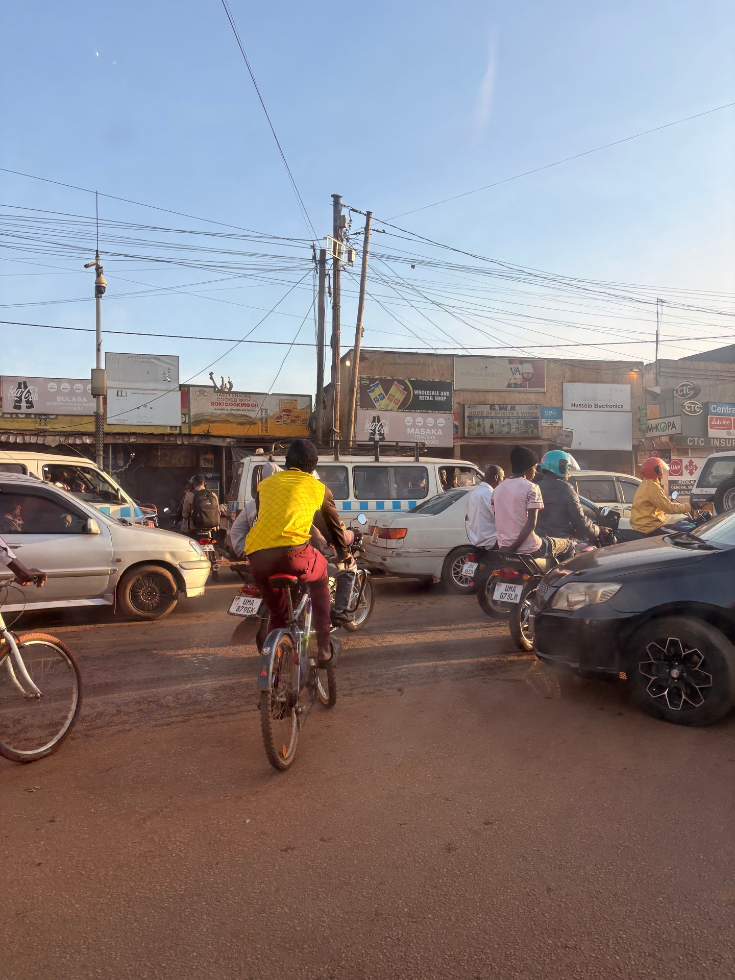
This economic weight produces a predictable physical reality: roads into and out of Kampala are heavily loaded at all hours, and severely congested during the morning and evening rush. The section of the Jinja Road (A109) that passes through the eastern Kampala divisions of Nakawa and Mukono is consistently the most congested stretch of the Kampala-Jinja route. From Kampala's Owino Market area — one of the city's major commercial nodes, established in 1971 and specialised in second-hand clothing and practical household goods — the journey through the city's eastern fringe before reaching open road takes anywhere from 30 minutes in off-peak hours to over 90 minutes in rush traffic.
When we were collected from Entebbe International Airport in January 2026 and driven through Kampala, the city's traffic character was immediately apparent — the density, the boda bodas threading between stationary vehicles, the roadside market activity continuing right to the edge of the carriageway. Driving through Kampala at a brisk pace requires either early morning timing or a driver who knows which parallel streets carry less traffic. On our May 2026 visit to Kampala, arriving directly from the airport, the same density was even more pronounced in the mid-afternoon heat — motorcycles, bicycles, and private vehicles competing for the same lanes in what appears chaotic but is in practice a negotiated urban mobility system with its own internal logic.
Why Jinja? The Destination at the End of the Road
Jinja sits at the northern shore of Lake Victoria at the point where the White Nile begins its 6,650-kilometre journey to the Mediterranean. The town is the established centre for adventure tourism in East Africa: white-water rafting on Class III–V Nile rapids, bungee jumping over the river, and kayaking are all available within a few kilometres of the town centre. The Source of the Nile monument is the most visited single attraction. The Jinja Sailing Club on Lake Victoria offers lakeside dining and accommodation for those who prefer a slower pace, and the Jinja Railway Museum — Uganda's first railway museum — runs locomotive tours and guided history programs. The Jinja Golf Club, established around 1920, occupies a lakeside 9-hole course and remains one of Uganda's most characterful sporting venues. Most visitors from Kampala come for a single day or a weekend; the journey time makes Jinja the most accessible major destination from the capital.
Kampala to Jinja: All Transport Options Compared
The Jinja Road (A109) connects Kampala's Old Park taxi stage to Jinja town over approximately 80 kilometres of well-maintained tarmac. The road quality is generally good by regional standards, though the section through Mukono and the approach to Jinja across the Owen Falls Dam bridge is subject to significant congestion. Allow 1.5 to 2.5 hours in normal conditions, and 3 or more hours if departing Kampala between 07:00 and 09:30 on weekdays.
| Option | Approx. cost | Journey time | Notes |
|---|---|---|---|
| Shared minibus taxi (matatu) | 10,000–15,000 UGX | 2–3.5 hrs | Departs Old Park when full; frequent throughout the day. No advance booking needed. |
| Express bus (long-haul coaches) | 15,000–25,000 UGX | 1.5–2.5 hrs | Kampala–Nairobi coaches stop at Jinja. Faster but infrequent; check departure times in advance. |
| Special hire (private taxi) | 80,000–150,000 UGX | 1.5–2.5 hrs | Negotiate price before departure. Useful for groups or early morning travel. |
| Pre-booked private transfer | USD 50–80 | 1.5–2.5 hrs | Booked via tour operator or hotel. Airport pickups with safari 4x4 vehicles are standard. |
| Boda boda (motortaxi) | Not recommended | — | Not practical for intercity travel with luggage. Use for short in-town distances only. |
What You Pass on the Kampala–Jinja Road
Leaving Kampala's Old Park stage heading east on the A109, the first major landmark is the Kampala Industrial and Business Park at Namanve — a 2,200-hectare industrial zone managed by the Uganda Investment Authority, visible from the road roughly 12 kilometres outside the city. The park's scale gives a clear signal that you have cleared the worst of Kampala's urban congestion. From Namanve, the road opens up through Mukono District before the approach to Jinja, where traffic reconcentrates at the Owen Falls Dam bridge — the crossing point into Jinja town. The bridge across the Owen Falls Dam is one of the more dramatic entry points on any Uganda road journey: the White Nile is visible below, spilling out of Lake Victoria at the point where its 6,650-kilometre journey to the Mediterranean begins. Traffic over the bridge tends to slow significantly — both from congestion and from the instinct of first-time visitors to look out the window. Budget an additional 10–20 minutes for this final approach into Jinja town.
A planned Kampala-Jinja Expressway — an upgrade to the existing A109 corridor — has been in development planning as a logistics improvement project; travellers should note that the current journey uses the existing highway, which is fully functional and well-surfaced throughout.
Shared Minibus Taxis: The Practical Choice
The matatu (shared minibus taxi) is the standard transport option for independent travellers, Ugandan residents, and anyone travelling without significant luggage. Vehicles depart from Kampala's Old Park taxi stage — on the eastern edge of the city centre — when full, running throughout the day without a fixed schedule. The standard vehicle is a 14-seat minibus; expect the vehicle to be fully loaded before departure.
Prices for the Kampala–Jinja route sit between 10,000 and 15,000 Ugandan shillings as of 2026 (approximately USD 2.70–4.00 at current exchange rates). These prices are subject to fuel cost fluctuations and should be confirmed on the day. The journey includes a crossing of the Owen Falls Dam bridge at Jinja — one of the more dramatic entry points to any Ugandan town, with the White Nile visible below.
Boda Bodas: Urban Mobility, Not Intercity Transport
The boda boda — Uganda's ubiquitous motorcycle taxi — is the dominant short-distance transport mode in both Kampala and Jinja, and in every town and rural area in between. In Kampala, boda bodas outnumber cars on many city streets and serve as the practical last-mile solution for navigating the city's traffic. On rural routes, as seen on our October 2024 drive, they carry extraordinary loads: water canisters, agricultural produce, passengers on the back seat, sometimes all simultaneously. Helmets are uncommon and riding in sandals is standard practice — a combination that would be illegal in most of Europe but is functional in a context where the road network and enforcement structures are different.
For visitors, boda bodas are useful for short distances within Jinja town or from a Kampala taxi stage to a hotel. For the intercity route with luggage, they are not practical. Agree on a price before boarding; no fare system is metered.
Private Transfers and Safari Vehicles
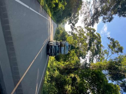
Visitors arriving as part of an organised itinerary are typically collected from Entebbe International Airport in a safari 4x4 — the standard logistics vehicle for Uganda's tour industry, combining roof-rack luggage capacity with the ground clearance needed for travel beyond paved roads. The Entebbe-to-Jinja transfer by this route covers approximately 135 kilometres and takes between 2.5 and 4 hours depending on Kampala traffic. Operators typically plan this transfer in one continuous drive; stopping in Kampala city centre is possible if arranged in advance.
Pre-booked transfers are the preferred option for visitors with fixed flight times or early morning onward connections. A private vehicle from Entebbe International Airport to Jinja covers approximately 135 kilometres and takes between 2.5 and 4 hours depending on Kampala traffic; operators typically drive this route in one continuous journey, crossing the city before heading east on the A109.
Jinja: The Source of the Nile and Uganda's Adventure Hub
Jinja sits at one of the most geographically significant points in Africa — the northern shore of Lake Victoria, where the White Nile begins its 6,650-kilometre northward journey to the Mediterranean. The GPS coordinates of the town's centre cluster around 0.45°N, 33.20°E; the source of the Nile, marked by a memorial on a small island accessible by boat, lies just offshore from the main waterfront. The Ripon Falls, which Speke identified as the Nile's origin in 1862, were submerged by the construction of the Owen Falls Dam (now Nalubaale Dam) in 1954, but the symbolic and ecological significance of the site remains intact.
The town's identity as East Africa's adventure capital is built on the stretch of the White Nile immediately below the dam: a series of Class IV and V rapids that have been the site of commercial white-water rafting operations since the early 2000s. The rafting corridor runs for approximately 25 kilometres downstream; full-day rafting trips take participants through multiple named rapids with grades ranging from manageable to genuinely demanding. Bungee jumping, kayaking, and stand-up paddleboarding are available from operators concentrated along the Nile's eastern bank. The adventure tourism infrastructure in Jinja is well-developed by regional standards, with a range of accommodation options from backpacker hostels to mid-range guesthouses with Nile views.
Accommodation in Jinja: Options on Arrival
Travellers arriving from Kampala have a range of options concentrated near the Nile and Lake Victoria waterfront. Jinja Nile Resort is the area's principal upscale property — 140 bungalows set on 12 hectares of riverside gardens, located 4 kilometres northeast of the town centre. For budget travellers, Jinja Backpackers on the Nile offers hostel accommodation directly on the riverbank with a bar and relaxed atmosphere suited to the adventure-tourism crowd. Mid-range accommodation clusters along the Nile Crescent road connecting the town centre to the source monument.
Jinja's Character Beyond Adventure Tourism
The Jinja of 2026 is more than its Nile activities. The town has developed a café and restaurant scene oriented toward both international visitors and Uganda's growing domestic middle class, and the Nile riverfront has several properties that offer accommodation without the adventure sports premium. The old Indian commercial quarter — a legacy of the Ugandan Asian community expelled in 1972 and substantially returned after 1986 — gives Jinja's historic centre a distinct architectural character. The main market and boda boda stages give the town its daily rhythm, and the road east from Jinja toward the Busia border crossing with Kenya carries heavy commercial freight throughout the day.
Katuna: The Uganda-Rwanda Border Crossing
For travellers moving between Uganda and Rwanda, the Katuna border crossing — located between Kabale (Uganda) and Gatuna (Rwanda) — is the primary land crossing point on this corridor. In 2014, Katuna handled 275,407 tourist crossings, representing 21.75% of all Uganda land border arrivals, making it the country's most significant road border by tourist volume, according to Uganda Tourism data for that year. Rwanda was the second-largest source of tourists to Uganda in 2014, accounting for 27.5% of all arrivals.
The Katuna crossing is relevant to travellers on the southern circuit combining gorilla trekking in Bwindi (Uganda) with Volcanoes National Park (Rwanda). Key practical points for the crossing include:
- Rwanda plastic bag prohibition — Rwanda maintains a strict ban on non-biodegradable plastic bags. Visitors crossing by road will have plastic bags removed at the border; pack all belongings in cloth or reusable bags before reaching Katuna to avoid disruption.
- Visa arrangements — Ugandan and Rwandan visas are separate documents, though the East African Tourist Visa covers Uganda, Rwanda, and Kenya in one instrument (verify current terms at time of travel).
- Currency exchange — Ugandan shillings are not usable in Rwanda; Rwandan francs are required across the border. Exchange facilities are available at the crossing but rates are more favourable in Kabale town. ATMs in Kigali and Musanze give better rates than border kiosks.
- Kabale town is the last significant provisioning and banking point before the border, approximately 15 kilometres from Katuna. The town holds tourism training institutions including the African College of Commerce and the Great Lakes Institute, reflecting the region's economic dependence on cross-border and wildlife tourism.
Uganda's Road Infrastructure: Investment and Context
Uganda's road network has been the subject of substantial public investment in recent years. The Kampala City Roads Rehabilitation Project (Project 1658), managed by the Kampala Capital City Authority (KCCA), had approved total budget costs of 469,078,389 thousand Ugandan shillings for financial year 2024/25 — a significant increase from 153,552,429 thousand UGX approved for 2023/24 (KCCA Ministerial Policy Statement 2024-25 — verify). External financing from the African Development Bank (ADB) contributed 308,006 million UGX to the 2024/25 budget, with the Japan International Cooperation Agency (JICA) separately financing 143 billion UGX for road maintenance machinery and equipment.
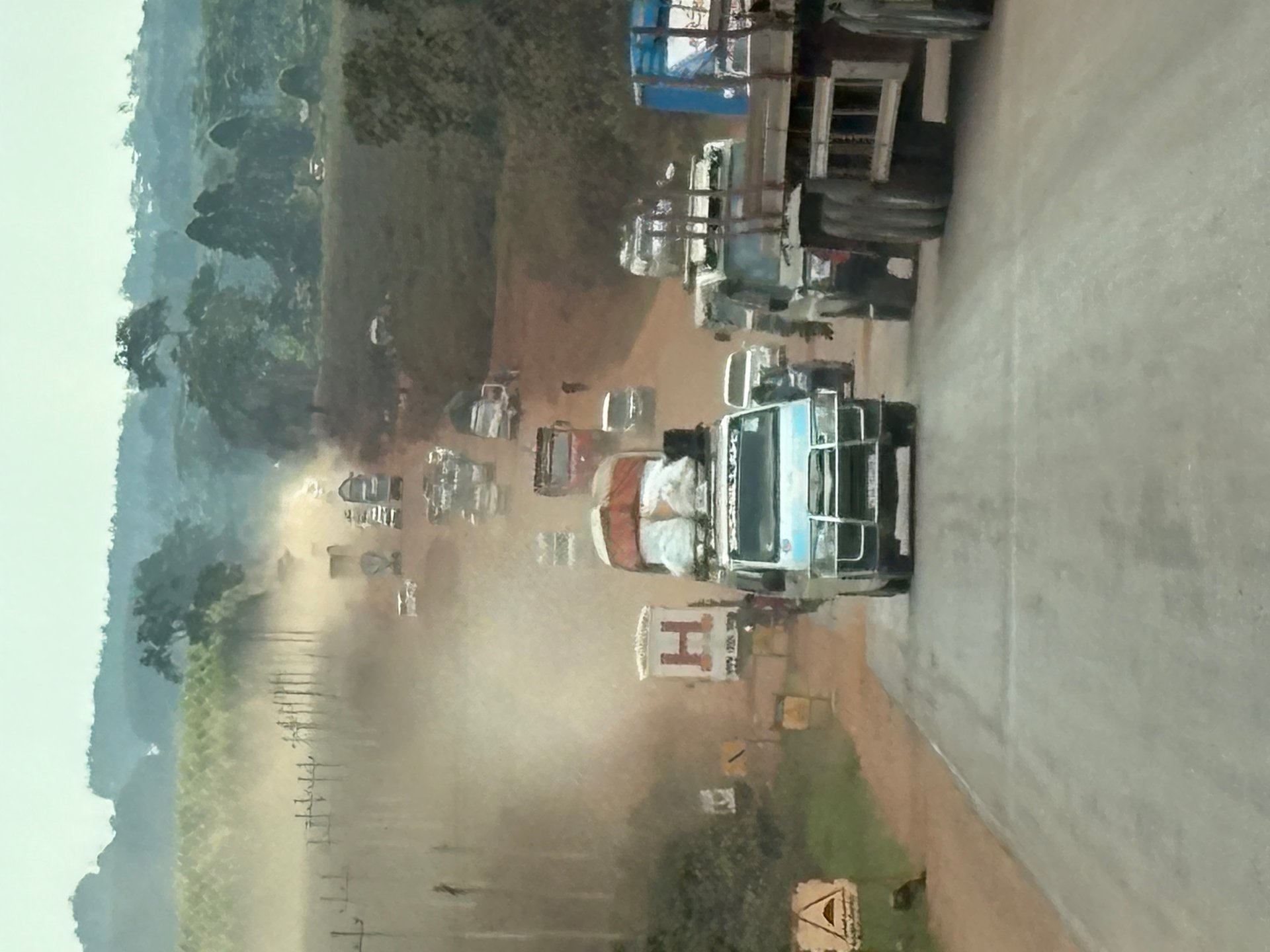
The project distributes rehabilitation funds across Kampala's five divisions: Makindye, Nakawa, Kawempe, Lubaga, and Central. The Masaka Highway — the primary road south from Kampala toward the Rwanda border corridor — was visibly under construction on the January 2026 drive, with significant sections still unpaved sand, heavy truck traffic, and a working surface shared by large vehicles, boda bodas, and local pedestrians. The investment is real and visible; the gap between budget allocation and completed surfaced road takes time to close.
Flooding remains a structural vulnerability on Kampala's road network. The Kampala Multi-Hazard Risk and Vulnerability Profile (August 2018) documents chronically flood-prone stretches including the Bwaise roundabout, Kampala Northern Bypass, Kalerwe-Gazaya road roundabout, the Jinja Road traffic lights area, and Kamwokya II — all sections that carry significant daily traffic and are affected by the city's eight main drainage channel systems (Nakivubo, Lubigi, Nalukolongo, Kansanga, Manyanja, Kinawataka, Nalubaga, and Walufumbe). Road users should plan for delays after heavy rain on these corridors.
Returning from Jinja to Kampala
The return journey from Jinja to Kampala follows the same A109 route in reverse. Shared matatus depart from the Jinja main taxi park throughout the day at the same fare — 10,000 to 15,000 UGX. The heaviest congestion on the Kampala approach occurs between 16:00 and 19:00 on weekdays. If you are completing a day trip, departing Jinja by 14:00 gives the best chance of clearing Kampala's eastern fringe before peak hours set in.
From the field
Frequently asked questions
How long does it take to get from Kampala to Jinja?
The approximately 80-kilometre journey from Kampala to Jinja takes between 1.5 and 2.5 hours under normal conditions on the Jinja Road (A109). Traffic through the eastern Kampala suburbs of Nakawa and Mukono — particularly between 07:00 and 09:30 on weekdays — can extend the journey to three hours or more. Departing before 07:00 or after 20:00 gives the best chance of a shorter trip.
How much does the bus from Kampala to Jinja cost?
Shared minibus taxis (matatus) from Kampala's Old Park taxi stage to Jinja typically cost 10,000 to 15,000 Ugandan shillings (approximately USD 2.70–4.00 at 2026 rates). Prices vary with fuel costs and should be confirmed on the day. Long-haul coaches travelling the Kampala–Nairobi route stop at Jinja and can be slightly faster. Private hire vehicles charge significantly more: 80,000–150,000 UGX for a special hire, or USD 50–80 for a pre-booked transfer.
What is the best way to get from Kampala to Jinja?
For independent travellers, the shared matatu from Old Park taxi stage is the most affordable and commonly used option — it runs throughout the day as vehicles fill and requires no advance booking. For visitors with luggage, time constraints, or early morning travel, a pre-booked private transfer through a tour operator or hotel is more reliable. Safari 4x4 vehicles with roof racks are the standard arrival vehicle for organised itineraries originating from Entebbe Airport.
What is Jinja known for?
Jinja is widely described as East Africa's adventure capital. It sits at the point where the White Nile begins its flow from Lake Victoria — the source of the Nile. The town is known for white-water rafting on the Nile (Class IV–V rapids), bungee jumping, kayaking, and stand-up paddleboarding. It also offers a growing café and restaurant scene, Nile riverfront accommodation, and a distinct architectural heritage from the historic Indian commercial quarter.
How do I get from Entebbe Airport to Jinja?
The most practical option is a pre-booked private transfer from Entebbe, covering approximately 135 kilometres via Kampala. Allow 2.5 to 4 hours depending on city traffic. Independent travellers can take a shared taxi from Entebbe to Kampala's Old Park, then a second taxi to Jinja — cheaper but more time-consuming and complicated with heavy luggage. Visitors on organised tours are typically collected from Entebbe in a safari 4x4 and driven directly, with Kampala crossed en route.
Is the Kampala–Jinja road (A109) in good condition?
The road is well-maintained tarmac for its full 80-kilometre length. The most challenging sections are the congestion points through Nakawa and Mukono leaving Kampala, and the bridge crossing at Owen Falls Dam entering Jinja. There are no significant potholes or unpaved stretches on this route; it is one of Uganda's best-maintained intercity roads.
Where do matatus to Jinja depart from in Kampala?
Shared minibuses for Jinja depart from the Old Park taxi stage on the eastern edge of Kampala's city centre. Vehicles depart when full — no advance booking is needed, and services run throughout the day from early morning until evening.
How far is it from Kampala to Jinja?
The distance from Kampala to Jinja is approximately 80 kilometres by road along National Highway A109. The route runs east from central Kampala through Nakawa and Mukono before reaching Jinja at the northern shore of Lake Victoria.
Can you do Jinja as a day trip from Kampala?
Yes. With a 1.5–2.5 hour journey each way, Jinja is the most accessible major destination from Kampala for a day trip. An early departure allows a full day of activities — white-water rafting on the Nile, the Source of the Nile monument, the Jinja Sailing Club, or the Jinja Railway Museum — before returning the same evening. Departing Jinja by 14:00 avoids the worst of the return congestion through Kampala.