Overview
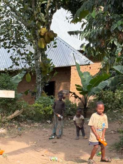
The village of Buhoma sits at the northern edge of Bwindi Impenetrable National Park, at GPS coordinates -0.9617, 29.6109, roughly eight hours by road from Kampala on a good day. In June 2026, early on a morning there, I encountered three children from the neighbourhood of the local orphanage. They stood shyly outside a simple mud-brick building with a corrugated iron roof — their clothes and bearing made it clear that things were not easy. We invited them to sit and eat with us immediately. It is not a dramatic scene; it is simply what you do.
That quiet moment in Buhoma captures something about the western Uganda corridor that maps and itineraries tend to leave out. The journey from Kampala to Fort Portal and onward through Kasese is not merely a logistical problem to solve before reaching a national park. It passes through a landscape of distinct towns, communities, and transitions — from the traffic and commerce of the capital, through the agricultural midlands, up into the Rwenzori foothills, and eventually to the forest edge. What you experience along the way depends entirely on how you travel and how much time you allow.
This guide is based on eight visits to western Uganda between October 2024 and June 2026, totalling over two weeks on the ground. It covers the transport options out of Kampala, the main stops and decision points along the route, and the character of Fort Portal and Kasese as bases for what lies beyond.
The Western Uganda Corridor: An Overview
The western corridor is Uganda's most travelled tourist route. It connects the capital to a sequence of significant protected areas: Kibale National Park for chimpanzee tracking, the Rwenzori Mountains National Park for high-altitude trekking, Queen Elizabeth National Park for game drives and boat safaris on the Kazinga Channel, and ultimately the southwestern parks of Bwindi and Mgahinga. No other route in Uganda offers this density of major wildlife destinations along a single corridor.
The route out of Kampala heads west through Wakiso District before climbing through the Mityana area and the gentle hills of the central plateau. After Mubende, the road begins a long descent toward the Rwenzori escarpment. Fort Portal, at around 1,500 metres above sea level, is where most travellers on this corridor spend their first night outside Kampala. From there, the road either continues southwest toward Kasese and Queen Elizabeth, or turns south toward Kibale and the crater lake region.
Uganda's road network on this corridor is substantially better than its reputation from a decade ago. The main tarmac road from Kampala to Fort Portal is maintained and passable in all weather by a standard vehicle. The stretch from Fort Portal to Kasese is similarly serviceable. What degrades beyond these main arteries — particularly the roads into national park areas and remote communities — requires a 4WD vehicle and more careful planning.
Getting Out of Kampala: Transport Options
Kampala's position as Uganda's transport hub means that departures for western Uganda are frequent and well-organised compared to many other East African capitals. The challenge is not availability but navigation — finding the right departure point, booking ahead with reliable operators, and managing the city's traffic on the way out.
By Coach or Bus
Several coach operators run daily services from Kampala to Fort Portal, departing typically from the bus parks around the city centre. Journey times are approximately five to six hours depending on the operator, the number of stops, and traffic on the Kampala side. Seats on the more reliable operators should be booked a day or more in advance, particularly for early-morning departures which tend to fill first.
For the Masindi and Budongo Forest Reserve direction — which lies northwest rather than due west — operators including Link Bus and the Uganda Post Bus run regular services. The Masindi route covers 220 kilometres from Kampala on a well-maintained tarmac road and takes approximately three to four hours by car or four to five hours by scheduled bus. Fares on the public bus services on this corridor are in the range of 25,000 Uganda shillings. These services connect travellers heading toward Murchison Falls National Park rather than Fort Portal directly, but are useful context for understanding the broader network out of Kampala.
For Fort Portal specifically, private coach services operate on fixed schedules. The quality difference between operators is significant — the gap between a newer air-conditioned coach with reserved seating and an older minibus with standing passengers represents a substantially different experience over a five-hour journey on winding mountain roads.
By Private Vehicle or Hired Car
Renting a 4WD vehicle in Kampala is the most flexible option and the only practical one for reaching remote destinations beyond the main tarmac route. Driver-guides with vehicles charge in the range of USD 80 per day with discounts available for multi-day arrangements. This rate typically includes fuel but excludes accommodation and meals for the driver — both of which are standard practice to cover as part of the rental arrangement.
Driving independently is possible for those with an international driving licence and experience in East African road conditions. The Kampala to Fort Portal road is manageable, but the Ugandan approach to overtaking, road-sharing with heavily loaded trucks, and the occasional unmarked speed bump in town centres requires full attention throughout. For travellers who want to stop at will, leave early, and control the pace of the journey, self-drive adds a dimension to the trip that bus travel cannot match.
| Mode | Kampala → Fort Portal | Approx. Journey Time | Cost Range | Best For |
|---|---|---|---|---|
| Coach / Bus | Multiple daily departures | 5–6 hours | UGX 25,000–60,000 | Budget travellers, solo |
| Private hire (with driver) | On request | 4–5 hours | USD 80+/day | Groups, remote access |
| Shared taxi (matatu) | From taxi parks | 5–7 hours (with changes) | UGX 20,000–35,000 | Very budget, flexible schedule |
| Self-drive 4WD | Rental companies in Kampala | 4–5 hours | USD 60–100+/day | Experienced drivers, maximum flexibility |
Leaving Early Matters
Whatever mode of transport you choose, the single most consistently useful piece of advice for this route is to leave Kampala before 7 a.m. The city's peak traffic begins building from 6:30 a.m. onward, and a journey that takes 20 minutes at 5 a.m. can easily take 90 minutes in morning gridlock. An early start not only escapes the traffic — it means arriving at Fort Portal in the early afternoon with time to settle, explore the town, and prepare for whatever comes next.
The Road West: Kampala to Fort Portal
The route from Kampala to Fort Portal passes through several distinct zones. The first hour is urban and peri-urban — Kampala's satellite districts of Wakiso and Mityana, where roadside commerce, fuel stations, and small trading centres follow each other with barely a gap. This stretch has the highest density of boda bodas, the two-wheeled motorcycle taxis that serve the informal transport needs of millions of Ugandans, and navigating it requires patience rather than speed.
Beyond Mityana, the landscape opens. The road climbs gradually through the Mubende district, passing through an agricultural zone of maize, banana, and tea cultivation. Mubende itself is a significant regional town with fuel, food, and basic services — a practical stop point roughly halfway along the journey. Many travellers who started early in Kampala take a food break here.
After Mubende, the road begins its descent toward the Rwenzori foothills. The landscape becomes noticeably greener as altitude increases and rainfall becomes more reliable. The quality of roadside vegetation changes — banana plantations give way to denser tropical growth, and the distant blue outline of the Rwenzori Mountains begins to appear on clear days. This section of the drive, from Mubende to Fort Portal, is among the more visually rewarding in Uganda.
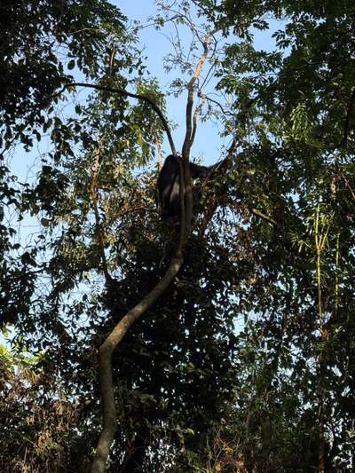
A mountain gorilla feeds in the canopy of Bwindi Impenetrable National Park — the destination at the far end of the western Uganda route. This family was encountered after approximately one hour of trekking in January 2026. Photo: Mark Suer (GPS: -0.9735, 29.6281)
During my January 2026 visit, the drive from Kampala through this section took just over four hours including the Mubende stop. The road surface was good throughout, and the most notable delays came not from road quality but from the standard Ugandan practice of police checkpoints on the outskirts of major towns — brief stops requiring documents, typically resolved in a few minutes when paperwork is in order.
Leave before 7 a.m. to avoid peak traffic. Main departure points: Kisenyi Bus Park (budget coaches), Old Taxi Park (shared taxis and matatus), or arranged hotel pickup for private hire.
First significant town west of Kampala. Fuel is available and reliable. The traffic density of the greater Kampala area thins noticeably past here.
Practical midpoint for a food and fuel stop. The town has basic restaurants serving local food, fuel stations, and a small market. The Rwenzori skyline becomes visible on clear days from the higher ground east of town.
Main town of the Rwenzori region and the primary overnight stop on this corridor. Full services, multiple accommodation tiers, and easy access to Kibale, Amabere caves, and crater lakes.
Western end of the main tarmac route. Gateway to Queen Elizabeth National Park and the Rwenzori Mountains trailheads. The Uganda Wildlife Training Institute is based here.
Fort Portal: The Rwenzori Gateway
Fort Portal is the most important staging town on the western Uganda corridor. At approximately 1,500 metres above sea level, it sits at the foot of the Rwenzori Mountains — the range known historically as the Mountains of the Moon and one of Africa's few permanently glaciated highland zones. The town serves the entire Rwenzori region and has developed a service infrastructure significantly above what the population alone would support, because it is the commercial hub for tourism across western Uganda.
The Tooro Palace in Fort Portal is the royal seat of the Tooro Kingdom, one of Uganda's constitutional monarchies. The palace grounds are accessible to visitors and represent one of the few places in Uganda where the continuity of pre-colonial royal institutions is both visible and actively maintained. The current palace is a relatively recent structure, but the Tooro Kingdom itself dates to the early nineteenth century.
A few kilometres outside Fort Portal, the Amabere Ga Nyinamwiru — literally "the breasts of Nyinamwiru" — are cave formations and waterfalls associated with a figure from Tooro legend. The stalactites that give the site its name drip into a small pool in a forested setting. It is a short and genuinely worthwhile excursion from Fort Portal, requiring perhaps two hours including the drive and the walk.
Fort Portal as a Trekking and Birding Base
Kibale National Park, approximately 35 kilometres south of Fort Portal, is accessible as a day trip from the town and is the most reliable location in the world for chimpanzee tracking. The park protects 13 primate species in total, and the forest trails around the Kanyanchu area offer a very different experience from the more open game-park environments of the Albertine Rift further south.
The crater lake region around Fort Portal — a series of volcanic explosion craters now filled with water, some surrounded by tea estates — is a compelling area for both day walks and multi-day exploration. The lakes vary in colour from emerald green to deep blue to the reddish-brown of crater lakes rich in minerals, and the surrounding ridges offer consistent views across a landscape that feels undiscovered relative to its quality.
Fort Portal also provides the most practical access point for beginning the Rwenzori Mountains traverse. The main trailheads are on the eastern face of the range and are reached via Kasese, but Fort Portal is where most trekking logistics — permits, guides, equipment hire — are arranged. [QUOTE: local guide on weather windows for the Rwenzori in different months]
Kasese: The Western Endpoint
Kasese is the furthest point on the main tarmac route west of Fort Portal, approximately 60 kilometres away. It sits at a lower altitude than Fort Portal, in the flat bottom of the Albertine Rift, and its character is notably different — drier, hotter, and more industrial in feel. The town grew around mining activity in the Rwenzori foothills, and while the copper mining operations that dominated its economy in the twentieth century have changed substantially, Kasese retains a working-town character that distinguishes it from the more tourist-facing Fort Portal.
The Uganda Wildlife Training Institute is based in Kasese, making the town a significant node in the national conservation system. The Institute trains rangers, wardens, and conservation staff for Uganda's protected area network — a function that gives Kasese an institutional importance within wildlife management that its modest tourist profile does not reflect.
Queen Elizabeth National Park begins just south of Kasese and extends to the borders with the Democratic Republic of Congo. The park encompasses the Kazinga Channel — a natural waterway connecting Lake George and Lake Edward — which supports one of the highest concentrations of hippopotamuses in Africa. The boat safari on the Kazinga Channel is among Uganda's most consistently rewarding wildlife experiences, accessible without the physical demands of gorilla trekking or mountain hiking.
The Rwenzori Trailheads
The standard entry point for Rwenzori Mountains National Park trekking is Nyakalengija, east of Kasese. The classic circuit through the Rwenzori takes approximately eight days and reaches the glaciated upper zones where peaks including Mount Stanley — at 5,109 metres Uganda's highest point — rise above the permanent snowline. A shorter three-day trek reaches the lower montane forest zones and the Bujuku River valley without the technical demands of the summit circuit.
The Rwenzori's weather is famously unpredictable. Rain can arrive at any point in the year, and the upper sections of the range are perpetually shrouded in cloud. The conventional trekking seasons (January–February and June–August) offer relatively better visibility and drier trail conditions, but "better" is a relative term in a range that receives some of the highest annual rainfall in Africa. [RECHERCHE NOETIG: current trekking fees and permit structure for Rwenzori Mountains National Park]
En-Route Detours: Extending the Western Corridor
The Northwest Loop via Masindi and the Ziwa Rhino Sanctuary
Travellers who want to extend their western journey northward can include Masindi in a broader loop. Masindi lies 220 kilometres northwest of Kampala on a well-maintained tarmac road, a drive of approximately three hours. The Ziwa Rhino Sanctuary, Uganda's only southern white rhinoceros breeding site, is located 50 kilometres before Masindi, just west of the main road. It offers the unusual experience of walking on foot alongside rhinos with a ranger escort — a wildlife encounter that most of East Africa cannot provide.
This Masindi loop connects naturally to Murchison Falls National Park, the largest protected area in Uganda and the location of the dramatic Nile rapids where the river forces itself through a seven-metre gap in the rock. Combining the northwest loop with the main western corridor makes for a demanding but comprehensive two-week itinerary through Uganda's most significant wildlife landscapes.
The Southwest Extension: Lake Mutanda and Bwindi
For those continuing from Kasese toward Bwindi and the southwest, the route passes through Ishaka and Rukungiri before reaching the approaches to Kisoro and the Virunga border zone. A rewarding addition to this section is Lake Mutanda, on the outskirts of Kisoro. Crossing the lake by traditional wooden dugout canoe — a two-hour paddle with an experienced local fisherman — is one of the more unusual transit experiences available in Uganda.
From Kisoro, two-day guided walking routes connect to the Bwindi sector lodges at Nkuringo or Buhoma, covering approximately 20 kilometres through highland farmland and forest margin. The route crosses Lake Mutanda by canoe at the midpoint and arrives at the lake-shore lodge on day one; the second day continues uphill through increasingly dense vegetation to the park edge. For travellers with the time and physical capability, this approach to Bwindi is considerably more immersive than arriving by road.
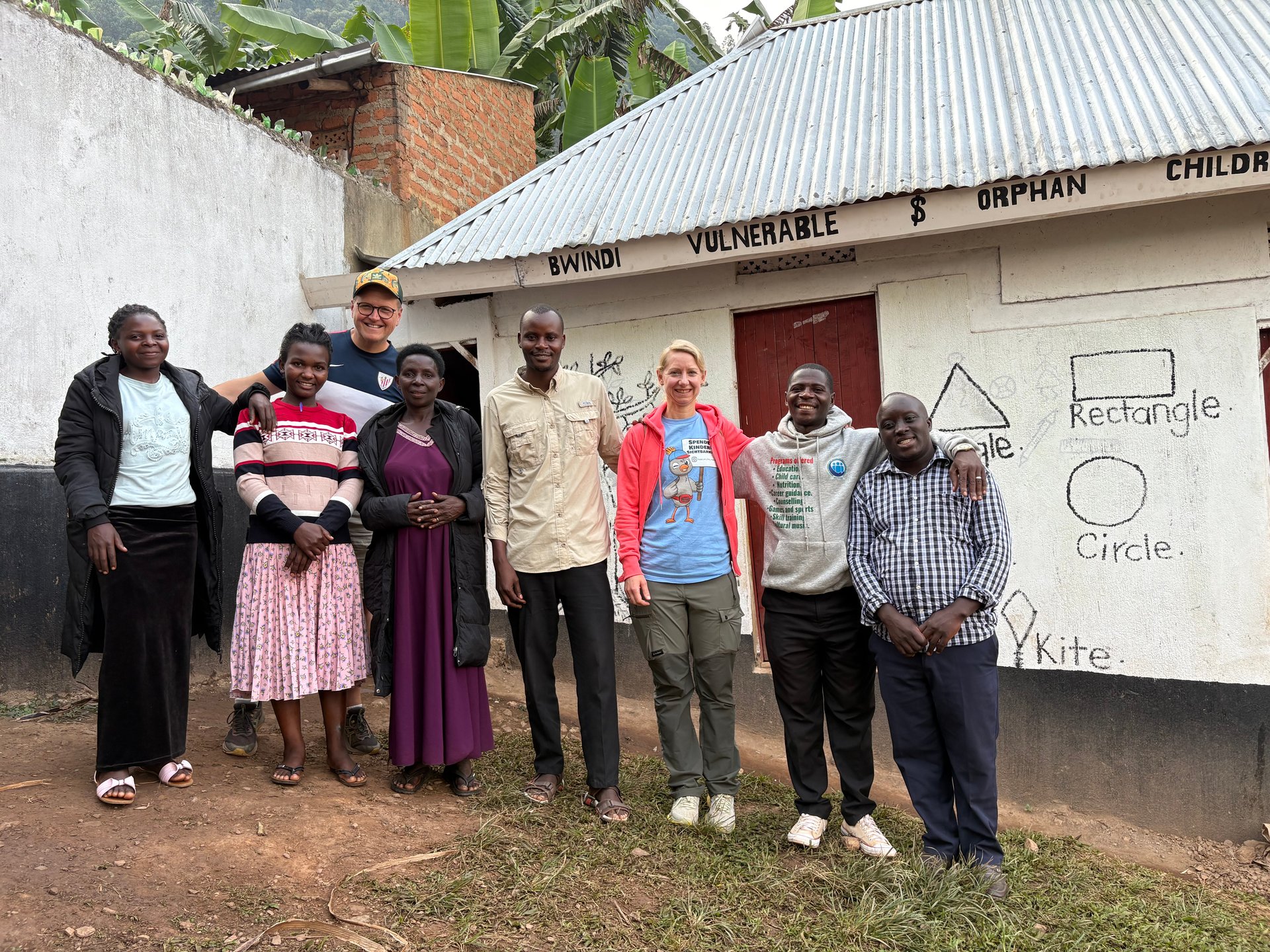
Community members in Buhoma, photographed in June 2026 at GPS -0.9617, 29.6108. Buhoma sits at the far end of the western Uganda travel corridor, where the road gives way to forest trails and gorilla country. Photo: Mark Suer
Practical Considerations for the Western Route
Timing and Season
The western corridor is accessible year-round, but the long rains of April and May affect road conditions on unpaved sections significantly. During my May 2026 visit, the main tarmac route from Kampala to Fort Portal was unaffected, but the tracks leading into Kibale forest and the minor roads in the crater lake area showed clear signs of recent heavy rain and required careful driving. June, when the rains ease, was noticeably drier and the roads into the national park areas had recovered.
The Rwenzori Mountains present a separate timing consideration. The range receives rainfall year-round, and conditions in the upper trekking zones depend on local weather patterns that can change within hours. Checking with local operators in Kasese or Fort Portal about current conditions at the trailhead is more reliable than generalised seasonal guidance.
Accommodation Strategy Along the Route
Fort Portal functions well as the main overnight stop between Kampala and the national parks. It has accommodation at all budget levels, good restaurants, and easy access to the crater lakes for an evening walk. Spending two nights in Fort Portal — with a day excursion to Kibale or the Amabere caves — is a practical structure for a first western Uganda trip before continuing to Kasese or the southwest.
Kasese itself has a smaller range of accommodation than Fort Portal but sufficient options for a night's rest before entering Queen Elizabeth National Park or beginning the Rwenzori. Budget accommodation in Kasese is basic; mid-range options exist but are limited in number and should be booked in advance during peak travel months.
From the field
Frequently asked questions
How long does it take to drive from Kampala to Fort Portal?
The drive from Kampala to Fort Portal covers approximately 300 kilometres on tarmac via Mityana and Mubende, and takes around 4 to 5 hours under normal conditions. Leaving before 7 a.m. avoids Kampala's peak traffic and is strongly advisable — the first 30 minutes out of the city can be the most time-consuming section of the entire journey during morning rush hour. Mubende, roughly halfway, is the standard food and fuel stop. From there the road improves in quality and the Rwenzori landscape begins to emerge on clear days.
Is there a bus from Kampala to Fort Portal?
Yes. Several coach operators run daily services from Kampala to Fort Portal, departing typically from bus parks in the city centre in the early morning. Journey times are approximately 5 to 6 hours. The better operators offer reserved seating and air conditioning; advance booking of at least one day is recommended. Shared taxis (matatus) also cover this route in stages, with changes at Mubende, but the total journey time is longer and comfort is significantly lower. For most travellers, a direct coach is the better public transport option.
What is Fort Portal known for?
Fort Portal is the main town of Uganda's Rwenzori region and serves as the gateway to Kibale National Park, the Rwenzori Mountains, the Tooro Palace, the Amabere Ga Nyinamwiru caves and waterfalls, and the volcanic crater lakes of the Tooro district. It is the most practical overnight stop between Kampala and the western national parks. The town has a relaxed character relative to Kampala and enough restaurants and guesthouses to support a comfortable two-night stay, which is the minimum needed to explore Kibale and the crater lakes as day excursions.
What is Kasese used for when visiting western Uganda?
Kasese is the western end of the main tarmac corridor and the primary base for those entering Queen Elizabeth National Park from the north or beginning the Rwenzori Mountains trek. The Uganda Wildlife Training Institute, which trains conservation personnel for protected areas across the country, is based in Kasese. Most visitors use Kasese as a transit point rather than a destination in itself, overnighting before entering Queen Elizabeth or before an early-morning transfer to the Rwenzori trailhead at Nyakalengija.
What is the Ziwa Rhino Sanctuary and is it worth stopping?
Ziwa Rhino Sanctuary is Uganda's only breeding ground for white rhinoceroses, located approximately 170 kilometres north of Kampala, just west of the Gulu highway near Masindi. It offers guided walking encounters with rhinos — one of the few places in East Africa where this is possible on foot rather than from a vehicle. The sanctuary is more convenient on the northwest route toward Masindi and Murchison Falls than on the direct western route to Fort Portal. Travellers combining both corridors in a loop itinerary can include Ziwa without significant detour; those going only to Fort Portal and Kasese would need to add a full day for the deviation north.