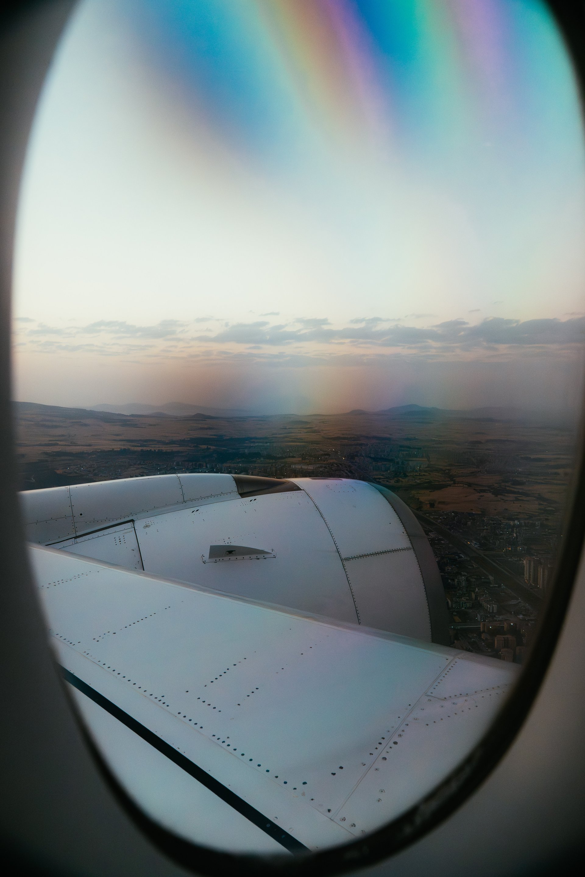
Overview
Lira is a city most visitors to Uganda have not planned for. It sits in the north, five to six hours from Kampala by road, beyond the geographic and psychological horizon of the southern safari circuit. It is not a national park gateway. It does not offer a specific wildlife experience that draws permit-holders. What Lira offers is something harder to category: a major Ugandan city in the middle of one of the most significant post-conflict recoveries on the African continent, normalising into something that resembles its own future.
For travellers with time and interest in understanding northern Uganda beyond its tragic past, Lira is a city worth including. This guide is practical, but it begins with context — because arriving without it means missing most of what the city is.
Lira and the LRA: What Happened Here
Between approximately 1987 and 2006, the Lord's Resistance Army (LRA) under Joseph Kony conducted an insurgency across northern Uganda that directly affected an estimated 1.7 to 2 million people (source: International Crisis Group). The Acholi and Langi regions — Gulu and Lira at their centres — bore the greatest impact. Villages were attacked, children abducted as fighters and domestic workers, and civilians displaced into large internally displaced persons (IDP) camps on the outskirts of towns including Lira.
The IDP camps that formed around Lira at the conflict's peak held hundreds of thousands of people in conditions of severe overcrowding. The camps were theoretically protected — government forces were present — but attacks still occurred, and disease, malnutrition, and lack of sanitation caused significant mortality independent of direct violence. The 2004 massacre at Barlonyo IDP camp, approximately 25 kilometres from Lira, killed an estimated 200 to 300 displaced persons in a single LRA raid (source: Human Rights Watch 2004).
By 2006, the Ugandan military's Operation Iron Fist and the beginning of peace talks in Juba had pushed the LRA out of northern Uganda. From 2007 onwards, IDP camps began to dissolve as people returned to their home areas. The return process was itself complex — two decades of displacement meant that land rights, farming knowledge, and community structures had all been disrupted.
In 2026, Lira is a functioning city of approximately 120,000 people (source: Uganda Bureau of Statistics national projections). The camps are gone. The streets hold a market, commerce, NGO offices, restaurants, and the ordinary texture of a northern Ugandan town. The recovery has been real. It has also been incomplete: trauma, land disputes, and economic exclusion from the predominantly southern structure of Uganda's development spending are ongoing.
Understanding this is not a reason to avoid Lira. It is a reason to arrive with attention.
Getting to Lira
From Kampala: The main road north (Kampala–Gulu highway) passes through Karuma and continues to Gulu; Lira is reached by turning east from Kamdini, approximately 30 kilometres before Gulu. Total distance from Kampala is approximately 340 kilometres. Road quality on the main northern highway is generally good by Ugandan standards; the final approach roads into Lira itself vary.
Buses operate from Old Taxi Park and Kisenyi in Kampala to Lira daily. Journey time is typically five to six hours depending on stops and traffic. Companies including Link Bus, Baheng, and Post Bus have served this route; departure times are morning-focused. Pre-booking is recommended for long weekends.
From Gulu: Lira is approximately 80 kilometres southeast of Gulu by road, typically one to one-and-a-half hours by private vehicle or shared taxi (matatu). Shared taxis from Gulu to Lira operate from the main taxi park in central Gulu.
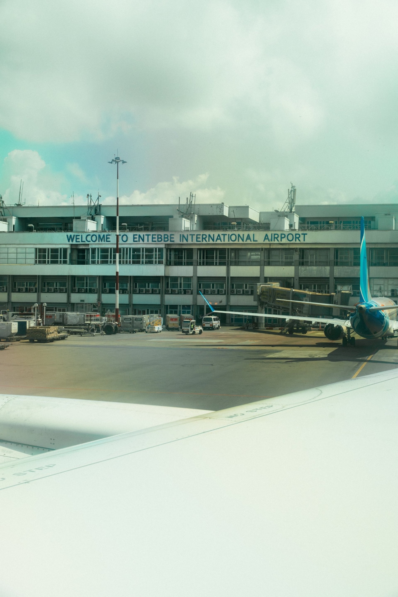
From Entebbe/Kampala by air: Lira has a small airstrip (Lira Airport, IATA: LRA) that handles charter flights. Scheduled commercial service has been inconsistent; check current availability with Ugandan charter operators if air access is required.
Where to Stay in Lira
Lira's accommodation has expanded considerably since the conflict period. The city now has a reasonable range of mid-range hotels catering primarily to business travellers, NGO workers, and visiting officials — the tourism infrastructure for international leisure visitors remains limited but functional.
Lira Hotel is the most established name in the city, with standard and superior rooms, a restaurant, and conference facilities. It is the default choice for visiting delegations and typically the highest-standard option available. Rates are in the mid-range by Ugandan standards (60–120 USD per night).
Several smaller guesthouses and budget lodges operate in the central business area and on the main Kampala road. Standards vary; ask at the central taxi park or NGO offices for current recommendations, as the market has continued to evolve.
What to See and Do in Lira
Lira Central Market is the commercial heart of the city and the place to spend a morning understanding what northern Uganda buys, grows, and trades. The market is large, busy, and not oriented towards international visitors — which is its value. Groundnuts, sorghum, millet, and dried fish are staples. The textile section sells chitenge fabric at prices significantly below Kampala rates.
Lake Kwania lies approximately 40 kilometres south of Lira, connected by a road through the Agago and Kole districts. The lake is part of the Lake Kyoga system and is fished commercially by lakeside communities. There is no formal tourism infrastructure at the lake, but it is accessible by private vehicle for day visits. Birdwatching at the lake margins can be productive.
Lake Bisina (also called Lake Salisbury) is further east, in the Katakwi District. Like Kwania, it is part of the broader Kyoga wetland system and relatively unexplored by tourists. The road east from Lira towards Soroti passes near the lake.
The Barlonyo Memorial at the site of the 2004 massacre, approximately 25 kilometres from Lira, is not a formalised tourist site in the conventional sense. The memorial is maintained by the local community. Visiting requires a local guide and should be approached with clear intention — this is a site of recent collective grief, not a heritage attraction. Community organisations in Lira can advise on appropriate approaches.
Ngetta Cliffs and surroundings offer an opportunity for hiking in the area around Lira. The Ngetta area, a few kilometres from the city centre, has rocky outcrops and the sort of landscape typical of the Lango sub-region — flat acacia savanna broken by granite outcrops, quite different from the forest landscapes of southwest Uganda.
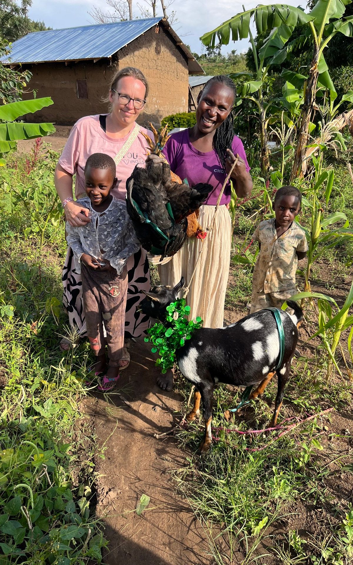
Community celebrations remain central to social life across northern and eastern Uganda. This goat donation ceremony, photographed in the Butiru area in October 2024, reflects the kind of social ritual that continued through and after the conflict period. Photo: Mark Suer.
Food and Eating in Lira
Lira has a range of restaurants oriented towards local tastes and the city's substantial working population.
Local staples available throughout the city: posho (maize meal), beans, groundnut stew, matooke, rolex (egg and vegetable rolled in a chapati — the Ugandan street food standard), and roast goat at the evening nyama choma stalls along the main roads.
Lira Hotel restaurant serves both local and continental dishes and is the most reliable option for international visitors unfamiliar with local ordering norms.
Market food around the central market area offers the cheapest and most locally authentic eating, though hygiene standards vary. Rolex stalls and bean-and-posho spots near the market are consistent and busy, which is generally a reliable indicator of quality.
The Langi and Acholi: Understanding the Cultural Context
Lira sits at the intersection of Langi and Acholi cultural zones. The Langi people (also called Lango) are the dominant group in the Lira District. They are linguistically and culturally related to the Acholi of Gulu, with a shared Nilotic heritage. The language is Luo — the same language group as Dholuo spoken in western Kenya, reflecting long-distance cultural connections that predate colonial boundaries.
The LRA conflict, and the post-conflict recovery, have shaped the relationship between northern identity and Ugandan national identity in ways that have not yet fully resolved. The north's sense of being an afterthought in national development planning — with infrastructure, investment, and political attention concentrated in the south — is not historical paranoia but a documented reality. Per capita income in northern Uganda remains significantly below national averages. Youth unemployment is high.
For visitors, this context matters not as a reason to stay away but as a reason to engage with Lira as a city in the middle of something — rather than as a place that used to have a problem and has now moved on.
Lira as a Base: Onward Connections
Lira connects to several other areas of interest in northern and eastern Uganda.
Gulu (80 km northwest): The largest city in northern Uganda, with more accommodation options and a more developed tourist infrastructure for the Acholi heritage and post-conflict narrative trails.
Kidepo Valley National Park (approximately 330 km northeast via Kitgum or Kaabong): Uganda's most remote national park, known for its dramatic semi-arid landscape and high density of wildlife rarely seen elsewhere in the country. The road from Lira to Kidepo is long and requires 4WD in places; most visitors access via small charter aircraft from Entebbe. Lira can serve as an overnight stop on a road trip north, though it is not the primary gateway.
Soroti and the Karamoja region (east): Soroti, approximately 100 km southeast of Lira, is the gateway to the Teso sub-region and onward to Moroto and the Karamoja highlands — a region with its own distinctive pastoral culture and landscape, rarely visited by international tourists.
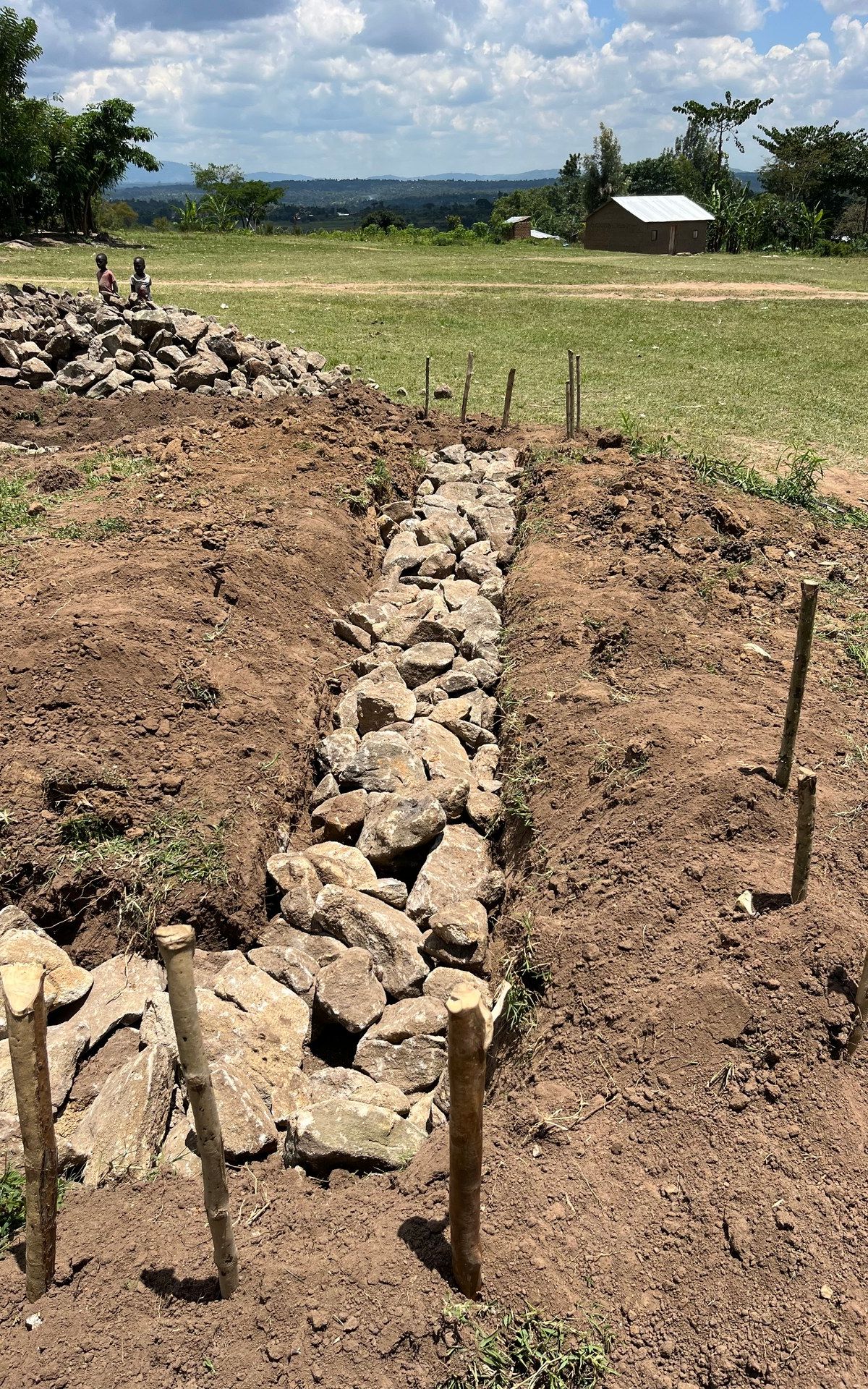
Traditional stone terracing near Butiru in eastern Uganda, photographed October 2024. This landscape feature, also common in the Kabale highlands in the southwest, reflects centuries of adaptation to hilly terrain. Eastern Uganda's agricultural landscape differs markedly from the forest-dominated southwest. Photo: Mark Suer.
Practical Information
Safety: Lira in 2026 is a safe city by the standards of northern Uganda's recent history. The LRA has not operated in Uganda since approximately 2006. Standard urban common sense applies — be aware of your surroundings, avoid displaying valuables, take registered taxis or boda-bodas through your hotel. The border regions (far north, far northeast) require more caution and current travel advisories should be checked; Lira itself does not carry elevated risk.
Currency: Ugandan shilling (UGX). ATMs are available in Lira town; the Stanbic and dfcu branches are the most reliable for international cards. USD cash is accepted at most hotels but at variable exchange rates; exchanging at a local forex bureau gives better rates.
Mobile connectivity: MTN and Airtel Uganda both have coverage in Lira. Data quality is adequate for messaging and navigation; video streaming is inconsistent outside central areas.
Health: Malaria is present in northern Uganda — prophylaxis and repellent are standard precautions. Drinking water should be bottled or purified. Medical facilities in Lira include Lira Regional Referral Hospital and several private clinics; for serious medical situations, evacuation to Kampala is the appropriate response.
Key Facts — Lira
- Region: Lango sub-region, northern Uganda
- Population: approximately 120,000 (urban; source: UBOS projections)
- Language: Luo (Langi dialect); English widely spoken
- Distance from Kampala: approximately 340 km (5–6 hours by road)
- Distance from Gulu: approximately 80 km (1–1.5 hours)
- Key lakes nearby: Lake Kwania, Lake Bisina
- Climate: tropical savanna; dry season November–March, rainy season March–May and August–November
Frequently asked questions
Is Lira safe to visit in 2026?
Yes. The LRA conflict ended in Uganda approximately in 2006 and the city has been stable since. Standard urban precautions apply. The wider northern region should be researched for current travel advisories before visiting, but Lira itself is not a security concern.
Why should I visit Lira rather than just Gulu?
Gulu has more established tourist infrastructure and is better positioned for the northern Uganda heritage narrative trail. Lira offers a different perspective — it is larger, more commercially active, and sits in Langi cultural territory rather than Acholi. Visitors with time to spend in the north benefit from understanding both. Lira makes sense as a stop on an itinerary that includes Gulu and continues east towards Kidepo or Karamoja.
How do I get from Kampala to Lira by bus?
Buses to Lira depart daily from Kampala's Old Taxi Park and Kisenyi area, with most departures in the morning. Journey time is five to six hours. Companies serving the route have included Link Bus, Post Bus, and Baheng; check current operators and schedules locally before travel. Booking the day before is advisable for morning departures.
Is Kidepo Valley National Park accessible from Lira?
Lira is roughly 330 km from Kidepo by road via Kitgum or Kaabong. The route is long and sections require 4WD. Most international visitors to Kidepo arrive by charter flight from Entebbe or Kampala. Lira can serve as an overnight rest stop on a road trip to Kidepo, but it is not the standard gateway.
What is the Lango culture and how does it differ from Acholi?
The Langi and Acholi are related Nilotic peoples with a shared Luo linguistic heritage. The Langi are centred in the Lira and surrounding districts; the Acholi in Gulu and the north. While both cultures share deep similarities — social structure, oral tradition, agricultural and pastoral practice — they are distinct communities with distinct political and historical experiences. The LRA conflict affected both, though the Acholi homeland (Gulu) was the original primary zone of operation. Related reading: Bwindi Impenetrable National Park · Gorilla Trekking in Uganda: The Complete Guide · Uganda Insights: All Articles