How to Get to Kidepo Valley National Park: Complete Transport Guide from Kampala
In 2013, CNN ranked Kidepo Valley National Park the third best national park in Africa. Over a decade later, very few travellers have acted on the recommendation. Uganda's Statistical Abstract 2025 records just 6,768 visitors to Kidepo for the year — down 11.1 percent on 2024, and a fraction of the figures recorded at Bwindi Impenetrable National Park, where foreign tourists make up 95.9 percent of all visitors. Kidepo remains, by every measurable standard, one of the most undervisited major parks on the continent.
That is almost entirely a consequence of geography. The park sits in the far north-eastern corner of Uganda, in the semi-arid Karamoja region, roughly 700 kilometres from Kampala by the northern road. Getting there requires planning, flexibility, and the right vehicle. But the journey through Uganda's north is not a punishment — it is an introduction to a part of the country that most visitors never see. The reward on arrival — over 77 mammal species, more than 450 bird species, approximately 600 African elephants, and a Narus Valley that you may have almost entirely to yourself — justifies every kilometre.
We travelled through northern Uganda in October 2024. Watching a matatu push north with a full load strapped to its roof — photographed by Mark Suer on the Murchison Falls highway — is one of the reliable reminders that long-distance overland travel in Uganda requires patience, humour, and a tolerance for creative logistics. The distance is real. The roads are real. But so is the destination.
This guide covers the three realistic options for reaching Kidepo: the northern route by road via Gulu and Kitgum, the longer eastern route via Mbale, Soroti, and Moroto, and the charter flight from Kampala or Entebbe.
Option 1: Northern Route — Kampala via Gulu, Kitgum, Karenga, Apoka
This is the most direct overland route and the one used by the majority of tour operators. Total distance from Kampala is approximately 700 kilometres; driving time under good conditions is nine to twelve hours. The standard approach is to split the drive with an overnight stop in Gulu or Kitgum.
Kampala to Gulu (340 km, approximately 4 hours)
The first leg follows the Kampala–Gulu highway north through Luwero and across the central plateau. The road is tarmac and in reasonable condition for most of its length. The Luwero Triangle — the corridor you cross roughly 80 kilometres north of Kampala — carries a heavy history from Uganda's civil conflicts of the 1980s, and a memorial near the road marks the scale of what happened. North of Karuma, where a bridge crosses the Victoria Nile above a narrow gorge, the landscape opens into low savanna and the pace of traffic drops noticeably.
Gulu is Uganda's second-largest city and the capital of the north. It has functioning ATMs, reliable fuel stations, a range of accommodation, and a lively central market. It is the last city in the conventional sense before the final approach to Kidepo. Stock up on cash here — there is no ATM access beyond Gulu on this route.
Gulu to Kitgum (130 km, approximately 2 hours)
East of Gulu the road narrows and traffic thins. Kitgum is the district headquarters and the last reliable point for fuel, supplies, and current road condition information. Guesthouses here are modest and functional; aid workers and overland travellers have used them for years. If you are breaking the northern route into two nights, Kitgum is the logical second stop.
Kitgum to Karenga (115 km, approximately 2–3 hours)
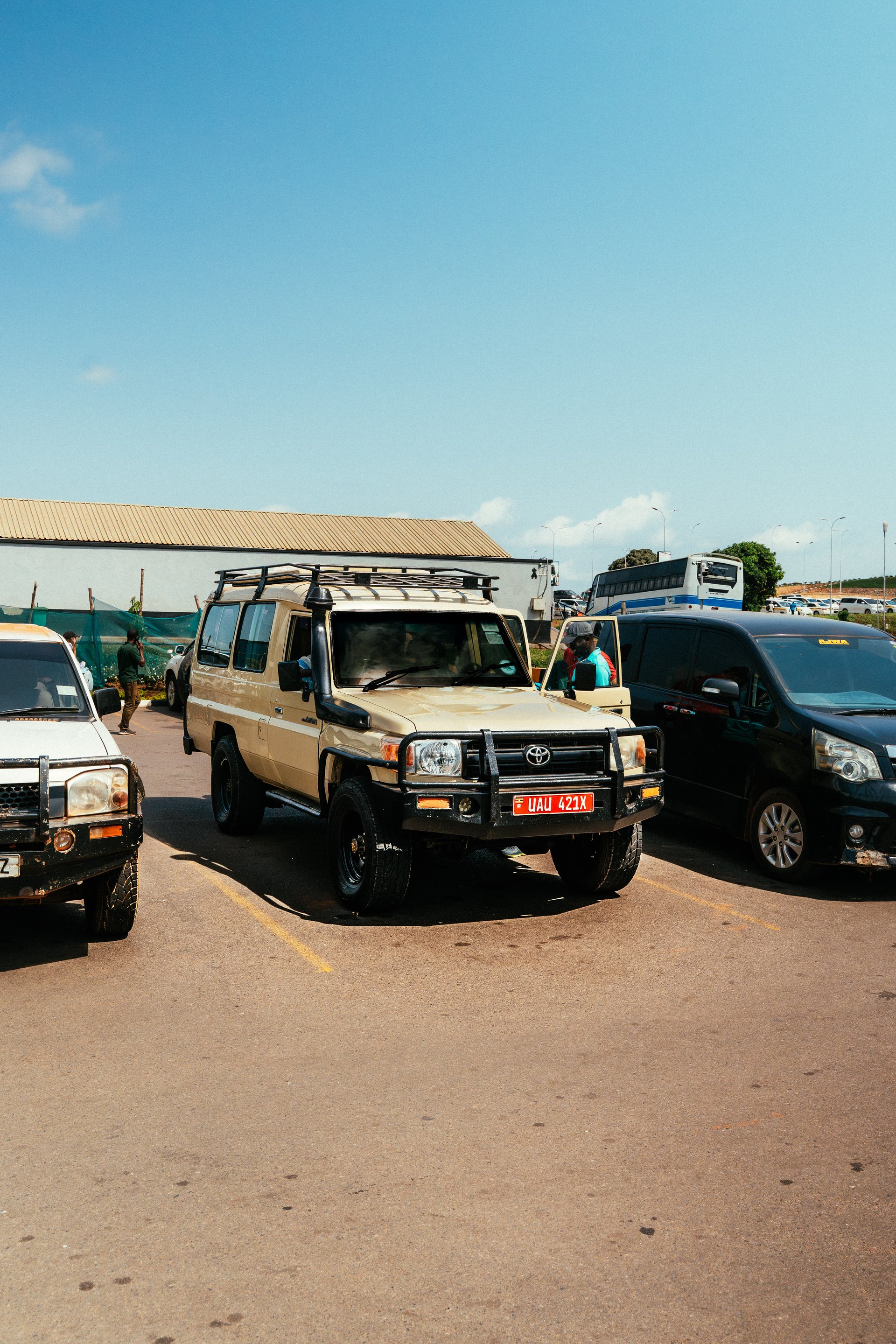
Beyond Kitgum the tarmac ends and the road becomes murram — compacted laterite gravel that turns to clay in rain and to dust in dry heat. This 115-kilometre stretch to Karenga can be covered in two to three hours with a capable 4WD (source: Reiseführer Uganda 2020). In the wet season, allow more time and carry a recovery strap. The landscape transforms progressively into Karamoja savanna: flat-topped acacias, termite mounds taller than a person, and the occasional Karamojong homestead ringed by a thorn-branch fence.
The town of Karenga is the gateway settlement for the park's southern approach. It is home to the Kidepo-Lorukul Cultural Village, an established cultural tourism attraction where visitors can meet Karamojong community members, observe traditional crafts, and learn about the pastoral culture that has defined this landscape for centuries. If time allows, this is worth a stop — it is one of the more genuine community-based tourism experiences in northern Uganda.
Karenga to Apoka Park HQ (25 km, Special Hire required)
The final 25 kilometres from Karenga to the park headquarters at Apoka require a Special Hire vehicle (source: Reiseführer Uganda 2020). This is not a section for improvised transport. Arrange this transfer in advance through your lodge, or hire a vehicle in Karenga. The road enters the Kidepo Valley ecosystem before it reaches the gate; by the time you arrive at Apoka, the landscape has already shifted into something remarkable.
Along the rural roads of northern Uganda — photographed by Mark Suer in October 2024 — the boda-boda is the universal last-mile solution. In Karamoja, where distances between settlements are long and formal public transport is scarce, the motorcycle taxi carries passengers, water, livestock, and whatever else needs moving. It is not the recommended mode for the final approach to Kidepo, but it represents the logistical reality of this region with an honesty that no organised tour can replicate.
Option 2: Eastern Route — Kampala via Mbale, Soroti, Moroto, Kaabong, Apoka
The eastern route is longer and takes at least two days to drive properly, but it passes through a richer sequence of landscapes and stops than the northern route. For travellers who want the journey to be part of the experience rather than just the means of arrival, this is the better option.
Kampala to Mbale (approx. 230 km, 4 hours)
The eastern route heads first toward Jinja and then follows the highway northeast toward Mbale, the largest city in eastern Uganda. The roads are good tarmac as far as Mbale.
Near Kumi: Nyero Rock Paintings
The first major cultural stop on the eastern route lies near Kumi, approximately 60 kilometres northwest of Mbale: the Nyero Rock Paintings, a series of ancient ochre-pigment designs on granite outcrops estimated to be several centuries old (source: Reiseführer Uganda 2020). The painted panels include concentric circles, boat-like shapes, and geometric forms whose precise meaning remains a matter of scholarly debate. The site is managed by the Uganda Museum and is one of the most important rock art sites in East Africa. Allow an hour for the visit.
Soroti and the Transition into Karamoja
From Kumi, the route continues to Soroti — a mid-sized town with reliable fuel and accommodation — and then northeast into Karamoja proper. This is where the landscape changes most dramatically: the green hills and cultivated plots of eastern Uganda give way to dry, wide valley floors and the characteristic semi-arid savanna of the Karamoja region.
Moroto and the Karamoja Museum
Moroto is the largest town in Karamoja and a logical overnight stop on the eastern route. It sits below Mount Moroto, and the surrounding landscape is striking in both its arid severity and its unexpected scale. The Karamoja Museum is located in Moroto and provides the most organised introduction to the culture, history, and ethnography of the Karamojong people available anywhere in the region. A visit here before entering Kidepo adds genuine context to what you will observe along the way. Note that from inside the park, on a clear day, the summit of Mount Lotuke across the border in South Sudan (2,797 metres) is visible on the northern horizon — a reminder of just how far north you have travelled.
Moroto to Kaabong to Apoka
From Moroto the route continues north through Kotido to Kaabong, the district headquarters closest to the park's eastern approach, and then through Karamoja to Apoka. Road quality on this section varies; a 4WD is mandatory. Total driving time from Moroto to Apoka is approximately four to six hours depending on conditions. The eastern route adds at least a full day to the overall journey compared to the northern route, but the accumulation of stops — Nyero, Moroto town, the Karamoja Museum, the landscape itself — makes the additional time worthwhile.
Option 3: Charter Flight to Kidepo Airstrip
Flight time: approximately 2 hours from Entebbe or Kajjansi Airfield near Kampala Cost: approximately 1,200 to 1,800 USD one way for the whole aircraft (verify current rates with operators, as fuel surcharges apply) Operator: Aerolink Uganda is the primary charter operator serving Kidepo's Apoka Airstrip
The charter flight is the fastest option and the only genuinely reliable one during the long rains (March to May), when the Karamoja roads can become impassable for days at a time. For small groups of three or more people, the cost per person becomes more comparable to the combined expense of a multi-day vehicle hire. The airstrip at Apoka is maintained by Uganda Wildlife Authority and can accommodate light charter aircraft.
Flying is also the more practical choice for travellers with fewer than five days available. The overland investment — two driving days minimum — only makes sense with at least three nights in the park. With a tight schedule, flying in and out maximises time on the ground in Kidepo itself.
What to See Along the Route
Nyero Rock Paintings (Eastern Route, near Kumi)
One of Uganda's most significant heritage sites and a compelling reason to choose the eastern route. The ochre paintings on natural rock faces have survived several centuries and offer a connection to a pre-colonial culture. The surrounding granite outcrops are beautiful in their own right (source: Reiseführer Uganda 2020).
The Karamoja Landscape and Its People
Whether you approach via the northern or eastern route, the transition into Karamoja is one of the most striking landscape shifts in Uganda. The savanna here is drier and wider than anything in the south or west. The Karamojong are a Nilotic pastoralist people whose culture has historically been organised around cattle and mobility. Some elders still wear elaborate beadwork and traditional dress. Passing through their territory at a pace imposed by the road is one of the more honest cultural encounters available in Uganda's national park circuit.
Moroto Town and the Karamoja Museum (Eastern Route)
For travellers on the eastern route, Moroto is more than a logistics stop. The Karamoja Museum provides depth on the region's history, ecology, and people. A morning here before the final drive to the park is time well spent.
Kidepo-Lorukul Cultural Village, Karenga (Northern Route)
This established cultural tourism attraction near Karenga is the most organised community-based cultural stop on the northern route. Activities typically include traditional dance, craft demonstrations, and guided walks through the homestead. Karamoja Wilderness Expeditions, a local tour company specialising in cultural tours and mountain and nature experiences in Karamoja, can arrange visits here as well as guided activities within the broader region.
Where to Stay at Kidepo
Accommodation at Kidepo is limited. This is by design — and it is part of what makes the park the experience it is. The three main options cover a range of budgets.
Kidepo Savannah Lodge
Operated by Nature-Lodges (Netherlands), opened in 2017, and located at the Kalokudo Gate. The lodge offers a combination of eight upmarket safari tents and nine simpler tents, making it the most varied option for mixed-budget groups. Full-board rates start from approximately 110 USD for two persons. The lodge has a strong reputation for guiding and for its community connections, and it is the most recently established of the main Kidepo accommodations.
Apoka Safari Lodge
Operated by Wildplaces Africa, this is the most luxurious option in the park. Ten cottages are set within the park boundary, and the lodge is positioned for game viewing directly from the terrace. It is the standard choice for high-end safari clients and for travellers whose primary priority is comfort. Request a current quote directly from Wildplaces Africa.
Apoka Rest Camp
Operated by Uganda Wildlife Authority (UWA), the Apoka Rest Camp offers bandas — basic self-contained rooms — at budget prices. This is the cheapest way to sleep inside the park and is used by Ugandan domestic visitors, budget travellers, and researchers. Standards are basic but functional. Book through UWA well in advance, as availability is limited even at this price point.
Best Time to Travel: Seasonal Guide
Getting the timing right for Kidepo matters more than for most Ugandan parks, because the road conditions directly affect whether the overland journey is achievable at all.
June to August — Peak Dry Season (Recommended)
The long dry season offers the firmest roads, the clearest game-viewing conditions, and the most predictable travel. Daytime temperatures in Karamoja climb into the low thirties, but mornings and evenings are cool. The Narus Valley grass is short enough in July and August to spot predators clearly, and the watering points draw concentrated wildlife.
December to February — Short Dry Season (Also Good)
A shorter dry window but reliable enough for overland travel. Wildlife visibility is good, and the landscape retains some green from the preceding short rains. This period is less crowded than the June–August peak.
October and November — Short Rains (Challenging but Rewarding)
The photographs used in this article were all taken by Mark Suer in October 2024, during a period when northern Uganda had received its first serious rains of the short rainy season. Roads north of Kampala were passable; the Karamoja stretch carries significantly more risk in this period. If you travel in October or November, a high-clearance 4WD is non-negotiable and a recovery strap is not an overreaction. The upside is genuine: the park is at its most lush, bird diversity peaks as migratory species arrive, and visitor numbers — already low by any standard — drop further. During our October 2024 travels through northern Uganda we had roads and landscapes almost entirely to ourselves.
March to May — Long Rains (Difficult)
The long rainy season brings the most challenging road conditions. Some sections of the Kitgum–Apoka road can become impassable even for well-equipped 4WD vehicles. Charter flight becomes the only reliable option in the worst weeks. If you are committed to overland travel in this period, consult UWA or a local operator immediately before departure.
Refuelling at a roadside station in rural Uganda, as Mark Suer documented in October 2024, is a practical reminder that infrastructure beyond Uganda's main towns operates on different assumptions than travellers from Europe or North America typically expect. Plan your fuel stops on the northern route carefully: Gulu is the last major fuel point, and availability in smaller settlements varies by season and by day.
Transport Comparison
| Method | Travel Time | Approx. Cost (one way, 2026) | Best For |
|---|---|---|---|
| Northern route 4WD (Kampala–Apoka) | 9–12 hours | 150–250 USD/day vehicle hire | Direct, most operators |
| Eastern route 4WD (via Mbale–Moroto) | 14–18 hours (2 days min.) | 150–250 USD/day vehicle hire | Scenic, cultural stops |
| Bus to Kitgum + Special Hire onward | 10–14 hours total | 35,000–55,000 UGX bus + transfer | Budget travellers |
| Charter flight (Entebbe to Apoka) | ~2 hours | 1,200–1,800 USD (whole aircraft) | Speed, comfort, wet season |
All costs are approximate and should be verified with operators at time of booking. Road conditions and fuel prices fluctuate seasonally.
Addressing the Safety Question
Karamoja has a documented reputation problem. Research on tourism in the region consistently identifies safety perception and associations with poverty as the primary barriers to visitor growth. The Karamoja Tourism Alliance, founded in 2019 to coordinate tourism development across the region, has acknowledged this directly in its positioning work. Uganda's national tourism strategy has set a goal of establishing Karamoja as a top destination for authentic cultural and nature experiences by 2030.
The factual situation in 2026 is considerably better than the reputation suggests. The disarmament campaigns of the 2000s and 2010s significantly reduced the armed cattle-raiding that historically made Karamoja dangerous for outsiders. Security has improved to the point where international tour operators now include Kidepo as a standard itinerary option without special advisories. The Uganda Tourism Board and UWA both operate in the region without special security protocols for visitors.
As with any remote destination in any country, standard precautions apply: check current travel advisories with your national foreign affairs ministry, inform your accommodation of your route and expected arrival time, avoid driving after dark, and consult local operators with current ground-level knowledge. Karamoja Wilderness Expeditions, which specialises in cultural and nature-based tourism in the region, is a useful contact for current conditions.
Visitor statistics from the Statistical Abstract 2025 tell their own story. Total Kidepo visitors were 6,768 in 2025, down from 8,343 in 2022, 7,824 in 2016, and 5,663 in 2015. The number was just 2,452 as recently as 2011 (source: Uganda Statistical Abstract 2025). Growth has been real, if inconsistent. The park handles the modest visitor numbers it receives without the pressure visible at more accessible destinations. Treating current Karamoja with the caution appropriate to conditions from fifteen or twenty years ago does the region and its people a disservice.
Practical Tips
- Book accommodation well in advance. All three main lodges have limited capacity. Apoka Safari Lodge and Kidepo Savannah Lodge fill early in the peak dry season. The UWA rest camp, despite its budget positioning, also books out.
- Carry sufficient cash from Kampala. ATM access ends in Gulu. Bring enough Ugandan shillings for fuel, food, park fees, and incidentals for the full journey — there is no ATM at Karenga or Apoka.
- Confirm road conditions before departure. Local operators in Kitgum have more current and reliable knowledge than any online source. If you are travelling independently, call ahead.
- Arrange the Karenga–Apoka Special Hire in advance. The final 25 kilometres require a hired vehicle. Your lodge can arrange this; confirm the detail before you leave Kampala.
- Allow at least three nights in the park. The drive investment only makes sense with sufficient time on the ground. Game drives in the Narus Valley are most productive in the early morning.
- Consider guided activities within the park. Nature Walks cost 30 USD per person. Cultural Tours are available for 30 USD per group.
- Carry more water than you expect to need. Karamoja is genuinely arid in the dry season. Four litres per person per day for the overland section beyond Kitgum is a minimum.
- Inform your accommodation of your expected arrival time. The gate at Apoka closes at sunset. If delays are likely, lodge staff need to know — they can arrange an escort from the gate.
For detailed transport options and what to expect at Kidepo, see our Kidepo Valley transport guide.
Frequently asked questions
How long does it take to drive from Kampala to Kidepo Valley National Park?
Using the northern route via Gulu and Kitgum, the drive takes between nine and twelve hours under good conditions, covering approximately 700 kilometres. Most travellers break the journey with an overnight stop in Gulu or Kitgum. The final section — 115 kilometres from Kitgum to Karenga (two to three hours by 4WD) plus 25 kilometres from Karenga to Apoka by Special Hire — completes the approach. Driving after dark is not advisable. Budget two days for the full overland journey from Kampala (source: Reiseführer Uganda 2020 ).
What is the difference between the northern and eastern route to Kidepo?
The northern route via Gulu and Kitgum is shorter and more direct — the standard choice for tour operators and for travellers focused on arriving efficiently. The eastern route via Mbale, Soroti, Moroto, and Kaabong is longer by at least a full day but passes through more varied terrain: the Nyero Rock Paintings near Kumi, the Karamoja Museum in Moroto, and a more gradual transition into the Karamoja landscape. If you have the time, the eastern route offers the richer experience. If you are on a tight schedule, take the northern route.
Is there a direct flight to Kidepo Valley National Park?
There are no scheduled commercial flights. Charter flights operate from Entebbe or Kajjansi Airfield near Kampala to Apoka Airstrip inside the park, with a flight time of approximately two hours. Aerolink Uganda is the primary charter operator. Costs range from approximately 1,200 to 1,800 USD for the whole aircraft one way. Flying is the only reliable option during the long rains (March to May).
What type of vehicle is needed to reach Kidepo?
A 4WD vehicle is essential for the sections beyond Kitgum on the northern route, or beyond Moroto on the eastern route. Standard saloon cars and regular minibuses cannot reliably manage the murram tracks leading to the park gate, particularly in wet conditions. High ground clearance matters more than four-wheel drive in the dry season; in the wet season, both are required.
Can I reach Kidepo by public transport?
Scheduled buses connect Kampala to Kitgum. From Kitgum, onward travel to Apoka requires a hired 4WD vehicle or a lodge transfer. The final 25 kilometres from Karenga to Apoka require a Special Hire. Public transport is unreliable beyond Kitgum, and the road to Karenga and Apoka is not served by regular matatus.
What is the best time of year to visit Kidepo?
June to August (long dry season) is the standard recommendation: firm roads, short grass, and predictable wildlife visibility. December to February (short dry season) is also reliable. October and November bring the short rains and make the Karamoja roads challenging but passable with a good 4WD — visitor numbers drop and the park is at its most green. March to May (long rains) is the most difficult period for overland travel; charter flight becomes the only dependable option.
Is it safe to travel through Karamoja to Kidepo?
Security conditions in Karamoja have improved significantly over the past fifteen years. The region is no longer subject to the armed cattle-raiding that made it genuinely dangerous for visitors in the early 2000s. International tour operators now include Kidepo as a standard itinerary item, and the Uganda Tourism Board and the Karamoja Tourism Alliance (founded 2019) are actively investing in the region's tourism infrastructure. Uganda's strategy aims to position Karamoja as a top destination for authentic cultural and nature tourism by 2030. Standard precautions apply — check current advisories with your national foreign ministry, avoid night driving, and consult local operators for conditions before departure.