Overview
Uganda covers 241,551 square kilometres straddling the equator on an elevated plateau in eastern-central Africa, according to the Uganda Statistical Abstract 2014. Its 2014 national census counted a population of 34,634,650, with a national average density of 143.4 persons per square kilometre and a median age of approximately 16 years. These numbers describe one of the most demographically young, rapidly urbanising, and ecologically diverse countries on the continent — a fact that becomes immediate when you stand in a village like Buhoma and look around.
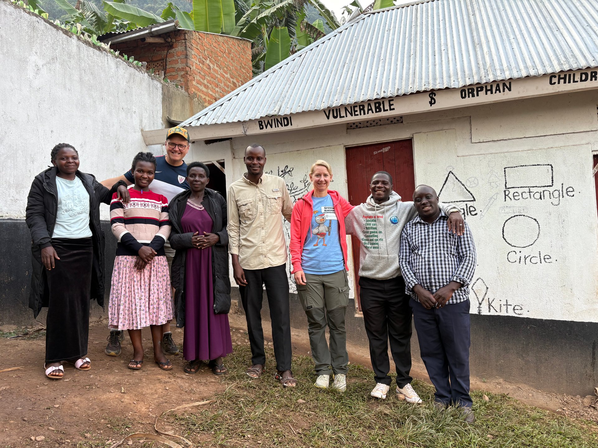
During a visit to Buhoma in June 2026 — GPS-verified at 0.9617°S, 29.6109°E, photographed by Mark Suer — three children from the neighbourhood of the local orphanage arrived at the edge of a meal being served. Their clothes and behaviour suggested circumstances that were difficult in ways that photographs cannot fully convey. They were hesitant at first. We invited them to join us. They did. That moment in June 2026 happened in the Kigezi highlands of southwestern Uganda, where population density exceeds 300 persons per square kilometre — among the highest in East Africa — in terrain that also contains Bwindi Impenetrable National Park, home to roughly 60 percent of the world's remaining mountain gorillas. The convergence of those two facts is not accidental. It explains much of what conservation in Uganda actually involves.
This article covers Uganda's geography and demographics in full: its equatorial position and what it means for climate and ecology, the regional distribution of its 34 million people, the dominance of Kampala in the national economy, Uganda's linguistic and religious landscape, and the human context that raw census data rarely captures.
Uganda on the Equator
The equator crosses Uganda east to west at approximately 0 degrees latitude, with the country extending to roughly 4 degrees north and 1.5 degrees south. This equatorial position, combined with the altitude of Uganda's central plateau — mostly between 1,000 and 1,500 metres above sea level — produces a climate that is neither the extreme heat of lowland equatorial zones nor the temperate conditions of higher mountain regions. The plateau moderates temperatures across most of the country to a range that rarely exceeds 30°C or drops below 15°C in inhabited areas.
The consequence is a near year-round growing season across most of Uganda — a crucial geographic advantage for a country where the large majority of the population depends on agriculture. Two rainy seasons annually (March–May and October–December) allow most parts of the country to grow two crops per year, with perennial crops like bananas, coffee, and tea productive in all seasons. The equatorial rainfall pattern, moderated by Lake Victoria in the south and the Rwenzori Mountains in the west, produces regional variation but rarely the prolonged dry seasons that devastate agriculture in Uganda's more arid northern neighbours.
The equator's position also explains Uganda's biodiversity. Sitting at the junction of east African and central African ecological zones — and containing the western arm of the East African Rift — Uganda hosts a concentration of species that would normally require travelling across multiple countries to encounter. More than 1,050 bird species, significant primate diversity including mountain gorillas and chimpanzees, and both savanna and forest megafauna are present within a country that is smaller than many individual African provinces. The equatorial position provides the energy (consistent solar radiation) and the moisture (bi-annual rains, lake effects) that sustain this diversity.
Uganda's Water Geography
Of Uganda's total 241,551 square kilometres, approximately 44,081 square kilometres consists of inland water — lakes, swamps, rivers, and wetlands that cover roughly 18 percent of the country's surface area. This exceptionally high water fraction for a landlocked country is primarily accounted for by the sections of Lake Victoria within Uganda's borders, along with Lakes Albert, Edward, George, and Kyoga. The Victoria Nile and Albert Nile river systems drain much of the country northward toward Sudan.
This water geography is economically and ecologically fundamental. The hydropower potential of the Nile at Jinja and Karuma drives Uganda's electricity generation. The Kiira and Nalubaale hydropower station duo at Jinja together produce significant baseload electricity from the Nile's outflow from Lake Victoria. Planned additions — the Tillenga Gas Power Project (80 MW) in the Bulisa district and the Kingfisher Gas Power Project (53.7 MW) in Kikuube — are scheduled around Uganda's oil development programme, while the Lisimba power project adds a further 180 MW. Off-grid energy operators like Winch Energy Uganda serve 31 sites in areas including Bunjako and Lamwo, addressing the substantial population outside the main grid.
The inland water bodies also support the fishing economy — Lake Victoria is one of the world's largest freshwater fisheries by volume — and the wetland ecosystems around the lakes hold critical habitat for bird species, Nile crocodile, hippo, and other wildlife that depend on permanent water. The wetlands around Mabamba Bay on Lake Victoria, accessible from Entebbe, are among the most reliable sites for shoebill stork sightings in Uganda.
Population by Region: The 2014 Census
Uganda's 2014 National Population and Housing Census, administered by the Uganda Bureau of Statistics (UBOS), recorded a total population of 34,634,650. The country is divided into four administrative regions — Central, Eastern, Northern, and Western — each with a distinct population profile.
| Region | Area (km²) | Population (2014) | Density (persons/km²) |
|---|---|---|---|
| Central | 61,403 | 9,529,238 | 155.2 |
| Eastern | 39,479 | 9,042,420 | 229.0 |
| Northern | 85,392 | 7,188,132 | 84.2 |
| Western | 55,277 | 8,874,860 | 160.6 |
| Uganda total | 241,551 | 34,634,650 | 143.4 |
Source: Uganda Bureau of Statistics, National Population and Housing Census 2014 — Main Report.
The Eastern region has the highest population density at 229 persons per square kilometre, concentrated particularly around the Mbale area and the fertile slopes of Mount Elgon. The Northern region, by contrast, covers the largest land area (85,392 km²) but records the lowest density at 84.2 — a reflection of the drier, less productive terrain in Karamoja and parts of West Nile, as well as the historical displacement caused by two decades of armed conflict involving the Lord's Resistance Army, which ended in active form around 2006 but left lasting demographic scars.
The Kigezi Highlands: Uganda's Most Densely Populated Rural Area
Within the broader Western region, the Kigezi highlands in the southwest — encompassing the districts around Kabale, Kisoro, and Kanungu — record population densities exceeding 300 persons per square kilometre, the highest in rural Uganda. This is the landscape immediately surrounding Bwindi Impenetrable National Park. The density figure is not a curiosity; it is the core conservation challenge that shapes everything about how the park is managed.
When 300 people share each square kilometre in terrain that can produce only a limited agricultural surplus, the park boundary becomes a frontier of economic pressure. Forest encroachment, firewood collection, snaring, and agricultural expansion into buffer zones are not abstract threats — they are the rational responses of households trying to feed themselves in one of the most land-constrained agricultural environments in Africa. The community revenue-sharing programme, the employment of local guides and rangers, the community tourism infrastructure at Buhoma, and the social programmes supporting households adjacent to the park all exist because the density data makes the stakes explicit.
The economic connection between visitor numbers and conservation funding is direct and measurable. Gorilla tracking at Bwindi and Mgahinga — the primary revenue stream for both the Uganda Wildlife Authority and the community revenue-sharing scheme — records occupancy rates of 70 to 100 percent during the high seasons of June to September and December to February. Outside those windows, occupancy drops to around 20 percent. The seasonal gap means that the conservation financing for one of the world's most critical primate habitats is neither stable nor evenly distributed across the year — a structural constraint that planning frameworks must account for.
The children photographed in June 2026 at GPS coordinates 0.9617°S, 29.6109°E — within walking distance of the Bwindi park boundary — are part of that demographic reality. Their situation is not anomalous; it is consistent with what the census data predicts.
Kampala: Capital City and Economic Concentration
Kampala is Uganda's capital and by a large margin its most economically significant city. It accounts for 80 percent of Uganda's industrial and commercial activity and generates approximately 65 percent of national GDP, according to the Kampala Capital City National Adaptation Plan (KCC-NAP, 2025). The city covers 189 square kilometres, divided into 169 square kilometres of land and 19 square kilometres of water, and is organised into five urban divisions: Central, Kawempe, Makindye, Nakawa, and Rubaga. It contains 99 parishes and 857 villages.
In 2015, Kampala was ranked the 13th fastest growing city in the world and named the best city to live in East Africa by one regional assessment (KCC Strategic Plan 2020/21–2024/25). Uganda's national urbanisation rate stands at 5.2 percent — among the highest on the African continent — which means Kampala and the secondary cities are absorbing population at a rate that significantly outpaces infrastructure investment. The population of greater Kampala city and its metropolitan area was approximately 4.8 million as of 2014, representing close to half the Central region's total.
Uganda remains one of the least urbanised countries in Africa despite this growth rate, with only 23.8 percent of the population living in urban areas as of 2018. The remaining 77 percent live in rural settings — predominantly in dispersed homesteads rather than nucleated villages, particularly in the south and west. Secondary cities including Jinja, Mbale, Mbarara, and Masaka provide regional economic centres but remain substantially smaller than Kampala. Jinja, on the Nile at the outflow of Lake Victoria, functions as Uganda's secondary industrial hub.
The Urbanisation Trajectory
Uganda's population growth averaged over 3 percent annually between 1980 and 2014. Urbanisation at 5.2 percent annually implies that cities are growing at nearly twice the national population growth rate — the urban share of total population is increasing even as rural numbers also rise in absolute terms. For Kampala specifically, this means persistent pressure on housing, transport, water, waste management, and public services at a scale the city's planning infrastructure was not built to accommodate.
The spatial consequence is a city that has expanded well beyond its formal boundaries into the surrounding Greater Kampala Metropolitan Area (GKMA). The GKMA encompasses Kampala City plus adjacent municipalities and towns, with the population of the broader area substantially exceeding the city's administrative boundaries. Planning for infrastructure, transport, and services within the GKMA requires coordination across multiple administrative jurisdictions — a governance challenge that has been the subject of successive planning frameworks.
Uganda's People: Languages, Faiths, and Age Structure
Uganda's linguistic landscape reflects its position at the intersection of two major African language families. The Niger-Congo family, which includes all Bantu languages, dominates the south, west, and east — encompassing Luganda (the most widely spoken indigenous language and the official language of the Buganda Kingdom), as well as the languages of the Banyankole, Basoga, Bagisu, and dozens of other groups. The Nilo-Saharan family covers the north and northeast, including the Acholi, Langi, Teso, and Karimojong peoples.
Uganda's two official languages are English and Swahili. English, introduced under British colonial administration, remains the medium of instruction in formal education and the language of government, law, and formal commerce. Swahili, added as an official language in 2005, is more widely used in the military, police, and border trade than in everyday urban life. Arabic is spoken by a small minority in Muslim trading communities, a legacy of Arab merchant networks in the pre-colonial period.
Religiously, Uganda is almost equally divided between Roman Catholics and Protestants — each accounting for approximately 42 percent of the population. This near-equal split is a direct product of colonial history: the Catholic White Fathers and the Anglican Church Missionary Society arrived in Buganda within years of each other in the 1870s and 1880s, competing intensely for converts and political influence in a series of events known as the Religious Wars of 1888–1892. Muslims comprise approximately 12 percent of the population, concentrated in the north and in trading communities across the country. A smaller percentage follows traditional indigenous belief systems, often in combination with Christianity or Islam.
A Nation of Young People
Uganda's median age of approximately 16 years as of 2018 makes it one of the youngest populations in the world. More than half the population is under the age at which most countries consider a person an adult. This demographic structure has profound implications for every sector of national life.
In education, it means an extremely large and growing cohort of school-age children requiring teachers, classrooms, and materials. Between 2009 and 2013 alone, a total of 10,679 students completed tourism-related courses in Uganda, according to the Statistical Abstract 2014 — a figure that reflects both the growth of formal tourism education and the deliberate policy of training young Ugandans for employment in the tourism sector. The Uganda Wildlife Training Institute (UWTI), which graduated 62 students in the 2012/13 academic year (47 male, 15 female), saw enrolment jump to 121 students in 2013/14 — a 24.8 percent increase that speaks to growing demand for conservation and wildlife management professionals.
In the labour market, the young age structure means a rapidly expanding workforce entering an economy where formal employment has not grown at the same pace. Organisations like Stichting SYPO (providing microfinance through SYPO Uganda Ltd.), the SUPREME project (youth skills development and entrepreneurship), and Graduation Programmes (the four-component poverty graduation model) all exist partly in response to this pressure: the need to provide economic pathways for a youth cohort larger than formal employment can absorb. The Rural Finance Initiative extends micro-financial services to communities including refugees and local populations in areas like the north where formal banking is absent.
Mount Elgon and Eastern Uganda
Uganda's eastern extremity is defined by Mount Elgon, a massive ancient shield volcano that straddles the Uganda-Kenya border. At 4,321 metres, it is the eighth-highest peak in Africa — a fact that is consistently underappreciated given the mountain's low profile in international climbing and trekking itineraries relative to Kilimanjaro or the Rwenzoris. Volcanic activity on Elgon began approximately 24 million years ago and the mountain last erupted around 10 million years ago, making it one of the oldest volcanoes in East Africa.
Mount Elgon National Park, created in 1993, covers 1,121 square kilometres of the Ugandan side of the massif. The park spans multiple vegetation zones from montane forest at lower elevations through bamboo and heath zones to the open moorland and caldera at the summit. The mountain is notable for its enormous caldera — one of the largest in the world — and for the cave-dwelling elephants of Kitum Cave in Kenya, though Ugandan elephants also frequent the mountain's caves to lick mineral salts from the walls.
The Eastern region's population density of 229 persons per square kilometre — second only to Kigezi in Uganda's rural zones — reflects the agricultural productivity of Elgon's lower slopes, where high rainfall and rich volcanic soils support dense smallholder farming. The Mbale area at the foot of the mountain is a regional trading hub, and the road connection to Kampala (approximately four to five hours) has historically made the east more economically integrated than the more remote north.
Frequently asked questions
What is Uganda's land area?
Uganda covers 241,551 square kilometres in total, of which approximately 197,470 km² is land and 44,081 km² is inland water — one of the highest water fractions of any African country, reflecting the presence of Lakes Victoria, Albert, Edward, George, and Kyoga within its borders. Uganda is located astride the equator on a plateau in eastern-central Africa, bordered by South Sudan, Kenya, Tanzania, Rwanda, and the Democratic Republic of Congo.
What is Uganda's population?
Uganda's 2014 National Population and Housing Census recorded 34,634,650 people, growing at over 3 percent annually since 1980. The Central region is most populous (9.53 million) followed by Eastern (9.04 million), Western (8.87 million), and Northern (7.19 million). By 2026 the population is estimated at approximately 46 million. The national population density in 2014 was 143.4 persons per km², with the Eastern region the densest at 229/km².
What are the official languages of Uganda?
Uganda's official languages are English and Swahili. Luganda is the official language of the Buganda Kingdom and is widely spoken in Kampala and central Uganda. Uganda's indigenous languages span the Niger-Congo family (Bantu languages of the south and west) and the Nilo-Saharan family (languages of the north and northeast). Arabic is spoken by a small minority in Muslim trading communities.
What religion is most common in Uganda?
Roman Catholics and Protestants (primarily Anglicans) each account for approximately 42 percent of Uganda's population — a near-equal split reflecting the parallel arrival of Catholic and Anglican missionaries in Buganda in the 1870s–1880s and the Religious Wars of 1888–1892. Muslims represent approximately 12 percent of the population, concentrated in the north and in trading communities. A smaller proportion adheres to traditional indigenous beliefs.
Why is Uganda's population so young?
Uganda has a median age of approximately 16 years — one of the lowest in the world — resulting from sustained high fertility rates over decades combined with declining but still elevated child mortality. More than half the population is under the age of 18. This demographic profile creates substantial demand for education, employment, and social services, and drives organisations including SYPO Uganda, the SUPREME project, and Graduation Programmes that specifically target economic integration for young Ugandans.